
Kansai: 31 Scenic Spots for a Day Trip, from Kyoto Temples to the Wakayama Coast
31 places · Japanese version
The Kansai region is full of views worth a day out, and none of the places below needs an overnight stay. The most famous city sights are left out on purpose, so the list leans toward Wakayama, which is not as far as it may seem. You will find mountain temples, a castle that floats on clouds, rock formations along the Pacific coast, long suspension bridges and hillsides covered in cherry blossoms or azaleas. The 31 spots are grouped by prefecture.
Kyoto Prefecture
Kasamatsu Park Amanohashidate
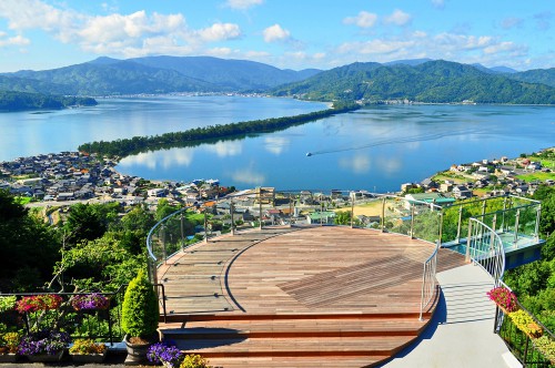
Amanohashidate is one of the Three Views of Japan, a long sandbar that has appeared in classical poetry for centuries and seems to form a bridge hanging in the sky. Kasamatsu Park, on its north side, is the place to look down on it, and it is known as the birthplace of matanozoki: bending over to see the view upside down between your legs. The sandbar is a short walk from Amanohashidate Station.
Tenryu-ji Arashiyama
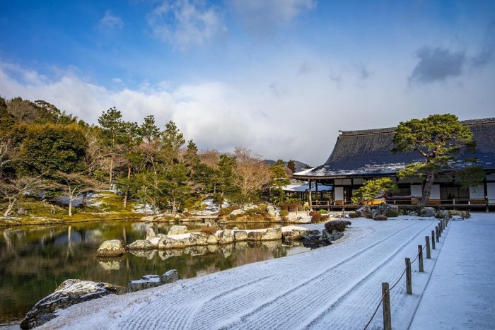
One of Kyoto's leading Rinzai Zen temples, Tenryu-ji was founded by Ashikaga Takauji and is known for honoring Emperor Go-Daigo. Its garden, made by Muso Soseki, is not a dry rock garden but a pond garden, combining the Sogenchi Pond in the center with Mount Kameyama behind it into one scene. The entrance is just past a T-junction after turning right out of Arashiyama Station on the Randen line.
Nanzen-ji Higashiyama
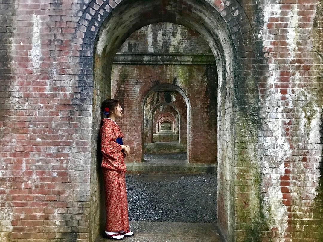
Nanzen-ji is a head temple of Rinzai Zen. Many of its buildings were lost to war, and the halls you see today were rebuilt in the Momoyama period. Besides its famous gate, it has sliding-door paintings of figures by the Kano school, and it is lovely in the autumn leaf season. From Keage Station on the Tozai subway line it is about a ten-minute walk through the Nejiri Mampo tunnel.
Kurama-dera Kurama
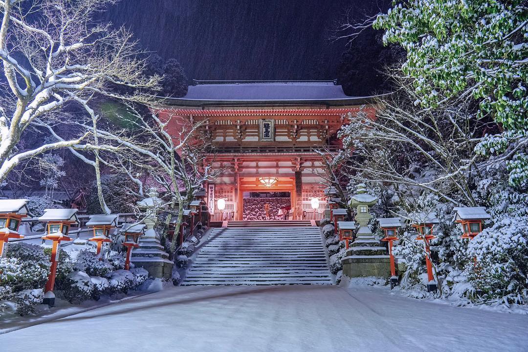
Kurama-dera is known as a power spot where prayers come true, and as the place where the young Ushiwakamaru, later Minamoto no Yoshitsune, trained. Look for the Kinone-michi, a path where tree roots crawl over the ground, and the view from about 400 m up. From Kurama Station it is about 30 minutes on foot up the mountain path, or a two-minute cable car ride plus about ten minutes' walk to the main hall.
Daihikaku Senko-ji Arashiyama
This Zen temple high on a hill is a hidden viewpoint over Arashiyama, a quiet escape from the crowds below. Getting there takes some effort: walk about 1 km along the Hozu River, then climb steps for about ten minutes. From the top you see the Higashiyama hills, the city of Kyoto, the sightseeing train and the Hozu River. It is about 30 minutes on foot from Arashiyama Station, and best in autumn leaves or fresh spring green.
Shiga Prefecture
Genkyuen Garden Hikone
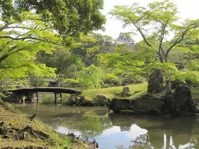
Genkyuen is a daimyo garden just northeast of Hikone Castle, made in 1677 in the image of the Eight Views of Omi. Many visitors still come to see this famous garden. Elegant events are held through the year, such as gatherings to listen to autumn insects in September and light-ups in November. From JR Hikone Station, head toward Hikone Castle.
Tarobo-gu (Aga Shrine) Higashiomi
Aga Shrine sits halfway up Mount Akagami, a triangular, partly rocky peak a little south of the Azuchi Castle ruins. The full climb is more than 700 stone steps, but you can drive part of the way and walk the last 200 or so from the parking lot. Just before the main hall you pass between the Fufu-iwa, two huge rocks tens of meters tall, said to bring good fortune. A wide view opens below the main hall.
Makino Highland Metasequoia Avenue Takashima
This avenue of metasequoia trees runs for 2.4 km and feels like a scene from a movie. You can drive through it or walk slowly along it. Autumn leaves are the best time, but the green of spring and summer and the snow of winter are beautiful too. Makino Highland next to it offers camping and skiing, so there is something to do all year. It is five minutes by car from Makino Station.
Chomei-ji Omihachiman
Chomei-ji is temple number 31 of the Saigoku 33 pilgrimage. From the Tarobo Gongen shrine a little above the main hall, Lake Biwa spreads out with Mount Hiei and the Hira mountains behind it, a view the writer Shirasu Masako praised as the most beautiful in Omi. The full climb is 808 stone steps, but you can drive up and walk only about 100 steps from the parking lot.
Hyogo Prefecture
Takeda Castle Ruins Asago
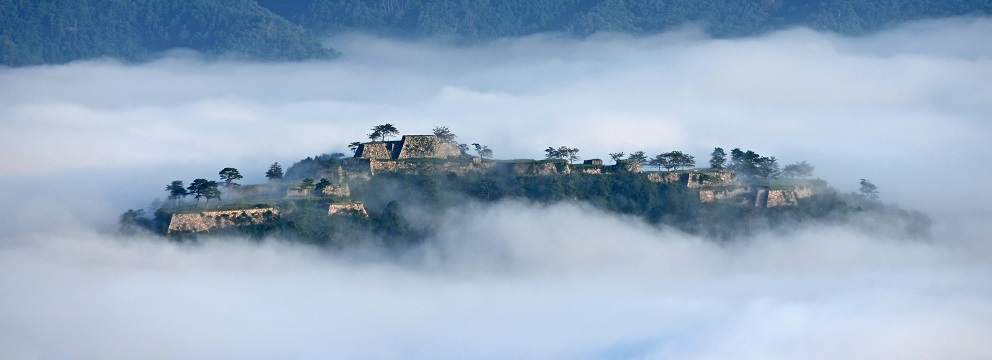
Only the ruins of Takeda Castle remain, but on early mornings they can look like a castle floating above a sea of clouds, with the sunrise breaking through. The way up feels like a mountain hike of about 40 minutes, so do not push yourself if you are not used to hills. The site is a national cultural property, so please mind your manners. Start from Takeda Station on the JR Bantan line.
Shiroyama Enchi Shin-onsen
Past the winding road up the Ashiya slope, this viewpoint looks out over the whole Sea of Japan. The sea is beautiful by day, and the place is also known for its sunsets, which have made it popular with couples. Access is from Hamasaka Station.
Osaka and Nara
Mount Kongo Chihayaakasaka
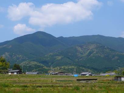
Mount Kongo, 1,125 m high, stands on the border of Nara and Osaka. A ropeway takes you close to the top, so the climb is easier than it sounds: from the upper station it is about 30 minutes on a maintained trail with steps. The six-minute ride itself has fine views of green valleys and, toward Sakai, the Osaka Plain. The upper station, at 975 m, also has an observation deck. Buses run from Tondabayashi and Kawachinagano stations.
Tanize Suspension Bridge Totsukawa
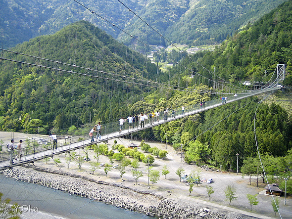
Now the best-known sight of Totsukawa Village, this bridge is known as the longest steel suspension bridge in Japan built for everyday use. Before it, villagers crossed on simple plank bridges that were washed away in every flood, so after the war they paid a huge sum to build it. Walking across while it sways is a thrill, and the view below is spectacular.
Mount Yoshino Yoshino
Mount Yoshino turns pink from top to bottom in cherry blossom season, a traditional Japanese scene praised in classical poetry. Every year crowds come to see its thousand cherry trees, usually in bloom from early to late April. The autumn leaves are lovely too. Take the Kintetsu limited express to Yoshino Station, then the ropeway from Senbonguchi to Yoshinoyama Station.
Odaigahara Kamikitayama
Known in legend as a mountain of demons where people lose their way, Odaigahara is split into East Odaigahara, with famous lookouts such as Mount Hidegatake, and West Odaigahara, covered in primeval forest. You can walk into the east side freely, but West Odaigahara needs an entry reservation, which opens three months ahead. Buses run from Yamato-Kamiichi Station on the Kintetsu line, about 1 hour 45 minutes.
Takatori Castle Ruins Takatori
Takatori Castle is counted with Matsuyama Castle and Iwamura Castle as one of Japan's three great mountain castles. Only the site remains today, but its vast grounds, ruins that blend with nature and the view from the heights have made it increasingly popular. It is about 25 minutes by car from Tsubosakayama Station on the Kintetsu Yoshino line.
Mount Yamato Katsuragi Gose
Next to Mount Kongo, Mount Katsuragi also has a ropeway that takes you near the top. The summit is a gentle plateau looking down on the Osaka Plain and the Nara Basin. The highlight is the azaleas from mid to late May, said to number a million, which turn the mountain bright red. It gets very crowded at the peak, and there is a lodge near the summit where you can stay.
Soni Highlands Soni
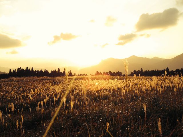
Soni Village, near the Mie border, holds a wide grassland surrounded by mountains. It is green in summer, and in autumn the pampas grass spreads like a golden carpet, a scene some visitors compare to the grasslands of Nausicaa of the Valley of the Wind. Hiking courses range from easy to hard, so you can choose one to suit you, and there is a hot spring facility nearby to rest afterward.
Wakayama Prefecture
Mushikui-iwa Rock Kozagawa
A national natural monument, this rock was eaten away by wind and rain until it looked as if insects had chewed it, which gave it its name. Legend says the countless honeycomb holes were left by a demon that loved to eat rocks. The area around it has many other oddly shaped rocks, and standing in front of it shows how big it really is. It is about ten minutes by car from Koza Station.
Dorokyo Gorge Shingu
This great gorge spans three prefectures around Kumano. It is divided into upper and lower parts, and the lower part, called Doro-hatcho, is famous for unusual and enormous rocks and scenery unlike anything else. Come and see these shapes made by nature for yourself.
Undersea Post Box Susami
Listed by Guinness as the deepest post box in the world, this mailbox sits under the sea off Susami and has been featured widely on TV. Buy waterproof paper at the nearby dive shop, Club Noah Susami, and your letter is sent like any other. Dive dates and times are arranged with the shop in advance.
Tomogashima Island Kada
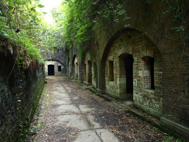
Tomogashima is the name for a group of islands in the Kitan Strait. They were once used as a fortress, and the remains are still there. Walk around the island past old gun battery sites and the lighthouse. The ferry pier is close to Kada Station, toward Kada Ohashi Bridge.
Kumano Kodo Kumano
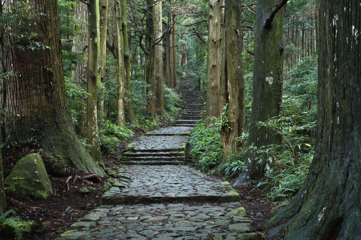
The Kumano Kodo is a World Heritage network of old roads that once linked sacred places and served as major routes. There are many: the Iseji between Kumano Hayatama Taisha and Ise Jingu, a road branching off it to Kumano Hongu Taisha, routes from Osaka and Wakayama to Kumano, a road on toward Nachi, and one to Koyasan. Kumano Hongu Taisha is at the center of the routes.
Shirasaki Coast Yura
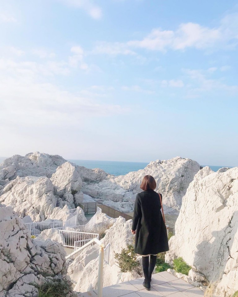
A classic scenic spot that appears in poems of the Man'yoshu, the Shirasaki Coast is a prefectural natural park dotted with white rock. The area is also well known for diving, and the clear sea is part of its appeal. Drive from Kii-Yura Station along the coast to Shirasaki Ocean Park.
Hashikui-iwa Rocks Kushimoto
About 40 rock pillars stand in a line stretching 850 m from Kushimoto toward Oshima Island. Legend says Kobo Daishi and an amanojaku demon made a bet and set them up in a single night. Like Umi-kongo, they are part of Yoshino-Kumano National Park, and they look lovely against the sunset. You can see them on the sea side of the road north from Kushimoto Station.
Engetsu Island Shirahama
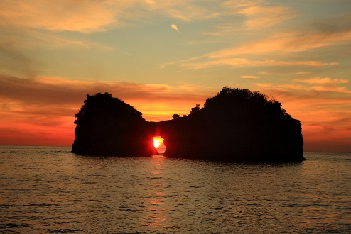
This small island off Nanki-Shirahama is officially called Takashima, but it got its popular name from the large round hole through its center. It is famous for sunsets, and coming at dusk gives you a romantic, beautiful view. Viewing is free. Take the Meiko town loop bus from JR Shirahama Station to the Rinkai stop, and the island is right there.
Umi-kongo Kushimoto
Part of Yoshino-Kumano National Park, Umi-kongo is named after the Kumgang Mountains, the most famous scenic area on the Korean Peninsula. Its sheer cliffs make a stunning view, and the sea and rocks glowing in the setting sun are beautiful too. Viewing is free all year. Drivers park at the Japan-US Friendship Memorial Hall and walk to the cliffs.
Nachi Falls Nachikatsuura
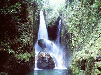
One of Japan's three great waterfalls, Nachi Falls drops 133 m and is known as the largest in Japan in both height and volume. It has been worshiped as the sacred body of a shrine since ancient times. On New Year's Eve it is lit up, so you can see its beauty at night as well. Take the Kumano Kotsu bus for Nachisan from Kii-Katsuura Station, about 30 minutes, then walk five minutes from the Nachi-no-taki-mae stop.
Gomasan Sky Tower Ryujin
This 33 m tower stands about halfway along the Koya Ryujin Skyline, the road from Koyasan to Ryujin Onsen. Because it sits high up, the observation deck looks out over beautiful mountains, and on clear days you can see as far as the mountains of Shikoku. There is a restaurant using local ingredients on the second floor. It is about 50 minutes by car from Koyasan Station and closed in winter, from December to March.
Cape Shionomisaki Kushimoto
Shionomisaki is the southernmost point of Honshu, with the wide Pacific spreading as far as you can see. The lighthouse here can be visited inside and has a museum next to it. From the observation tower at Shionomisaki Tourist Tower the view is unbroken, and you can watch the horizon curve. Climb it and you get a certificate for visiting the southern tip of Honshu, and its restaurant serves Kindai tuna.
Senjojiki and Sandanbeki Shirahama
Senjojiki is a wide rock shelf said to be big enough for a thousand tatami mats, shaped by Pacific waves over a very long time. You can walk on it down toward the sea, and the sunsets are superb. Nearby Sandanbeki is a line of sheer cliffs pounded by waves, with a lookout and a cave you can go down into, 36 m below ground. Both are about 15 minutes by car from Shirahama Station.
The places on a map
Hours, prices and events change. Check each place's official website before you go.
More travel guides
 Tokyo Sightseeing by Area: 40 Classic Sights and Lesser-Known Spots from Asakusa to Odaiba40 placesTokyo has much more to see than Skytree, Tokyo Tower and Asakusa. This guide works through six of the city's main…
 Nagoya: 40 Best Places to Visit, from Nagoya Castle and Atsuta Jingu to Osu40 placesNagoya is one of Japan's biggest cities, yet many visitors don't know how much it has to see. Alongside its famous…
 Chichibu: 40 Best Places to Visit, from Nagatoro River Boats and Mitsumine Shrine to Moss Phlox and Icicles40 placesChichibu, the largest city in Saitama Prefecture, is about 90 minutes from central Tokyo. Most of the area is national…
 Niigata Prefecture: 40 Best Places to Visit, from Classic Sights to Hidden Gems40 placesNiigata Prefecture stretches a long way from north to south, and each area has its own scenery, climate and food. The…
 Nagasaki Prefecture: 40 Best Places to Visit, from Unzen Hot Springs to Hirado and Nagasaki City40 placesNagasaki grew up as a port open to the outside world, and the culture of those days still shapes its streets, churches…
 Fukuoka Prefecture: 40 Places to Visit in Kitakyushu, Chikuho and Around Fukuoka City40 placesFukuoka Prefecture is roughly divided into four areas, Kitakyushu, Chikuho, Fukuoka and Chikugo, and each has its own…